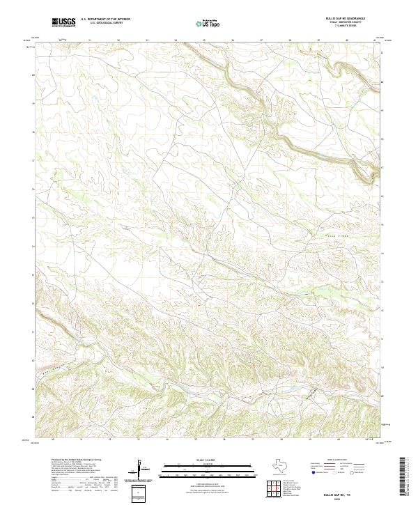
2022 Map of Bullis Gap NE
USGS Topo · Published 2022About this map
San Francisco Creek snakes through the southern reaches of this Brewster County landscape, defining the local drainage patterns alongside Maxon Cr and Horse Creek. The terrain is deeply incised by a series of prominent canyons, including Brindle Canyon in the north and the descriptively named Beef Canyon to the southwest. This 2022 survey illustrates a largely unpopulated area where the natural geography of Cow Creek and its various branches dictate the movement of water and the few primitive roads that traverse the hills. The intricate contour lines reveal the dramatic elevation changes that characterize this portion of the Texas frontier, providing a clear view of the land's physical structure as it existed in the early twenty-first century.
Find a feature on this map
8 named features on this map. Tap any name to fly to it.
Don’t see what you’re looking for? This feature index may not catch every label — zoom into the map to look around manually.
Map Details
Editions of this 2022 Bullis Gap NE Map
This is the sole edition of this map. No revisions or reprints were ever made.
Other maps of this area

1918 · Bullis Gap
USGS Topo · 1:62,500

1918 · Indian Wells
USGS Topo · 1:62,500

1920 · Longfellow
USGS Topo · 1:125,000

1928 · Sanderson
USGS Topo · 1:125,000

1954 · Fort Stockton
USGS Topo · 1:250,000

1958 · Fort Stockton
USGS Topo · 1:250,000

1959 · Emory Peak
USGS Topo · 1:250,000

1965 · Emory Peak
USGS Topo · 1:250,000

1968 · Big Brindle Canyon
USGS Topo · 1:24,000

1968 · Fresno Creek
USGS Topo · 1:24,000