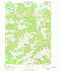
1970 Map of Bullis Mills
USGS Topo · Published 1972About this map
Bullis Mills and the surrounding borderlands of McKean County sit at the confluence of industry and agriculture in the early 1970s. The Allegheny River and Oswayo Creek carve through the landscape, defining the northern reaches of the quadrangle where the Penn Central tracks and an Old Railroad Grade trace the valley floors. The presence of the Sartwell Oil Field, Annin Oil Field, and Ceres Oil Field signals the region's long-standing reliance on resource extraction, with numerous oil wells and gas wells peppered across the hillsides of Eldred and Annin townships.
Find a feature on this map
48 named features on this map. Tap any name to fly to it.
Don’t see what you’re looking for? This feature index may not catch every label — zoom into the map to look around manually.
Map Details
Editions of this 1970 Bullis Mills Map
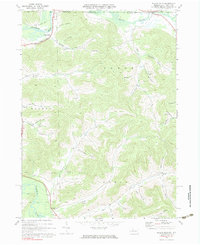
2 editions found
Other maps of this area

1898 · Olean
USGS Topo · 1:62,500

1925 · Belmont
USGS Topo · 1:62,500

1933 · Smethport
USGS Topo · 1:62,500

1934 · Coudersport
USGS Topo · 1:48,000

1937 · Smethport
USGS Topo · 1:62,500

1938 · Coudersport
USGS Topo · 1:62,500

1938 · Olean
USGS Topo · 1:62,500

1939 · Belmont
USGS Topo · 1:62,500

1943 · Olean
USGS Topo · 1:62,500

1957 · Warren
USGS Topo · 1:250,000