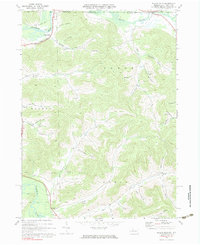
1970 Map of Bullis Mills
USGS Topo · Published 1983About this map
Bullis Mills and the surrounding borderlands of McKean County sit at a geographic crossroads where the Allegheny River and Oswayo Creek meet the New York state line. In 1970, this region remained heavily defined by its industrial roots, with the Sartwell Oil Field and numerous scattered Gas Wells and Oil Wells dotting the deep valleys and ridges. Transportation infrastructure tells the story of changing eras, from the active Penn Central line crossing the river to a bypass of the Old Railroad Grade near the northern border.
Find a feature on this map
50 named features on this map. Tap any name to fly to it.
Don’t see what you’re looking for? This feature index may not catch every label — zoom into the map to look around manually.
Map Details
Editions of this 1970 Bullis Mills Map
2 editions found
Other maps of this area

1898 · Olean
USGS Topo · 1:62,500

1925 · Belmont
USGS Topo · 1:62,500

1933 · Smethport
USGS Topo · 1:62,500

1934 · Coudersport
USGS Topo · 1:48,000

1937 · Smethport
USGS Topo · 1:62,500

1938 · Coudersport
USGS Topo · 1:62,500

1938 · Olean
USGS Topo · 1:62,500

1939 · Belmont
USGS Topo · 1:62,500

1943 · Olean
USGS Topo · 1:62,500

1957 · Warren
USGS Topo · 1:250,000