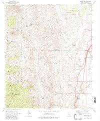
1969 Map of Bumble Bee
USGS Topo · Published 1980About this map
Bumble Bee sits at the heart of this late-1960s survey, a small settlement positioned between the eastern slopes of the Bradshaw Mountains and the elevated expanse of Black Mesa. The landscape is a complex network of deep drainages and mineral prospects, reflecting a long history of exploration in this corner of the Prescott National Forest. Evidence of hard-rock mining is scattered across the terrain, from the Howard Silver Mine and Howard Copper Mine to the Roosevelt Mine and Last Chance Mine near Turkey Creek. Transportation through these canyons evolved from the narrow Jeep Trails and Pack Trails that service interior landmarks like Castle Creek Cabin to the modern engineering of the Sunset Point Interchange along the primary highway corridor. Water sources such as Bill Arp Spring and Lower Dead Cow Spring appear as critical points of interest in this arid environment.
Find a feature on this map
60 named features on this map. Tap any name to fly to it.
Don’t see what you’re looking for? This feature index may not catch every label — zoom into the map to look around manually.
Map Details
Editions of this 1969 Bumble Bee Map
4 editions found
Other maps of this area

1887 · Prescott
USGS Topo · 1:250,000

1892 · Prescott
USGS Topo · 1:250,000

1903 · Bradshaw Mountains
USGS Topo · 1:125,000

1947 · Crown King
USGS Topo · 1:62,500

1947 · Bumblebee
USGS Topo · 1:62,500

1947 · Mayer
USGS Topo · 1:62,500

1947 · Mt. Union
USGS Topo · 1:62,500

1948 · Bumblebee
USGS Topo · 1:63,360

1948 · Crown King
USGS Topo · 1:63,360

1948 · Mt. Union
USGS Topo · 1:63,360