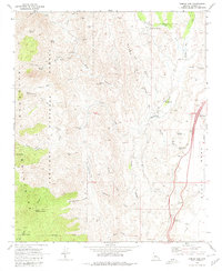
1969 Map of Bumble Bee
USGS Topo · Published 1980About this map
The Bumble Bee settlement serves as a central point in this late-1960s survey of Yavapai County, where the transition from traditional mining to modern infrastructure is clearly visible. The landscape is defined by the steep drainages of the Bradshaw Mountains, including Tiger Canyon and Black Canyon, which are punctuated by numerous historic mining sites. Prospectors and genealogists can identify several named operations such as the Bill Arp Mine, Thunderbolt Mine, and the Bimetals Mine.
Find a feature on this map
51 named features on this map. Tap any name to fly to it.
Don’t see what you’re looking for? This feature index may not catch every label — zoom into the map to look around manually.
Map Details
Editions of this 1969 Bumble Bee Map
4 editions found
Other maps of this area

1887 · Prescott
USGS Topo · 1:250,000

1892 · Prescott
USGS Topo · 1:250,000

1903 · Bradshaw Mountains
USGS Topo · 1:125,000

1947 · Crown King
USGS Topo · 1:62,500

1947 · Bumblebee
USGS Topo · 1:62,500

1947 · Mayer
USGS Topo · 1:62,500

1947 · Mt. Union
USGS Topo · 1:62,500

1948 · Bumblebee
USGS Topo · 1:63,360

1948 · Crown King
USGS Topo · 1:63,360

1948 · Mt. Union
USGS Topo · 1:63,360