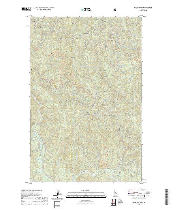
2024 Map of Bumblebee Peak
USGS Topo · Published 2024About this map
The Coeur d'Alene Mountains dominate this high-elevation landscape within the Coeur d'Alene National Forest, where the border of Kootenai and Shoshone counties follows the ridgelines. Central to the map is Bumblebee Peak, a prominent summit overlooking a complex network of drainage basins including Bumblebee Creek and Dismal Creek. The settlement of Laverne and the open flats of Bumblebee Meadow provide the primary points of human reference in an area otherwise defined by timber management and recreational infrastructure.
Find a feature on this map
64 named features on this map. Tap any name to fly to it.
Don’t see what you’re looking for? This feature index may not catch every label — zoom into the map to look around manually.
Map Details
Editions of this 2024 Bumblebee Peak Map
This is the sole edition of this map. No revisions or reprints were ever made.
Other maps of this area

1909 · Cataldo
USGS Topo · 1:125,000

1911 · Cataldo
USGS Topo · 1:125,000

1955 · Spokane
USGS Topo · 1:250,000

1957 · Kingston
USGS Topo · 1:62,500

1957 · Kellogg
USGS Topo · 1:62,500

1958 · Spokane
USGS Topo · 1:250,000

1961 · Lakeview
USGS Topo · 1:62,500
1966 · Spyglass Peak
USGS Topo · 1:24,000
1985 · Kellogg West
USGS Topo · 1:24,000
1985 · Skitwish Peak
USGS Topo · 1:24,000