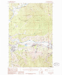
1985 Map of Kellogg West
USGS Topo · Published 1985About this map
Industrial activity along the South Fork Coeur D'Alene River defines this mid-1980s landscape in Shoshone County. Extensive Tailings deposits between Smelterville and Kellogg signify the region's deep mining and smelting history, while the proximity of the Shoshone County Airport and a Golf Course indicate the area's development into a regional hub. The map captures a moment when traditional industry and civic infrastructure coexisted at the edge of the Coeur D'Alene National Forest.
Find a feature on this map
61 named features on this map. Tap any name to fly to it.
Don’t see what you’re looking for? This feature index may not catch every label — zoom into the map to look around manually.
Map Details
Editions of this 1985 Kellogg West Map
2 editions found
Other maps of this area

1901 · Coeur D'Alene District
USGS Topo · 1:62,500

1903 · Coeur D'Alene District
USGS Topo · 1:62,500

1906 · Coeur D'Alene District
USGS Topo · 1:62,500

1909 · Cataldo
USGS Topo · 1:125,000

1911 · Cataldo
USGS Topo · 1:125,000

1950 · Twin Crags
USGS Topo · 1:24,000

1952 · Twin Crags
USGS Topo · 1:24,000

1955 · Spokane
USGS Topo · 1:250,000

1957 · Kingston
USGS Topo · 1:62,500

1957 · Kellogg
USGS Topo · 1:62,500