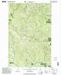
1996 Map of Bumblebee Peak
USGS Topo · Published 1999About this map
Bumblebee Peak stands as the central landmark in this high-elevation portion of the Coeur d'Alene National Forest during the late 1990s. The landscape is defined by the winding course of the Little North Fork Coeur d'Alene River along the western boundary, fed by a dense network of tributaries including Leiberg Creek, Hemlock Creek, and Bumblebee Creek. The terrain is characterized by high ridges and saddles, such as Shell Ridge, Skull Saddle, and Stull Saddle, which served as critical navigation points for forest management and local travel.
Find a feature on this map
33 named features on this map. Tap any name to fly to it.
Don’t see what you’re looking for? This feature index may not catch every label — zoom into the map to look around manually.
Map Details
Editions of this 1996 Bumblebee Peak Map
This is the sole edition of this map. No revisions or reprints were ever made.
Other maps of this area

1909 · Cataldo
USGS Topo · 1:125,000

1911 · Cataldo
USGS Topo · 1:125,000

1955 · Spokane
USGS Topo · 1:250,000

1957 · Kingston
USGS Topo · 1:62,500

1957 · Kellogg
USGS Topo · 1:62,500

1958 · Spokane
USGS Topo · 1:250,000

1961 · Lakeview
USGS Topo · 1:62,500
1966 · Spyglass Peak
USGS Topo · 1:24,000
1985 · Kellogg West
USGS Topo · 1:24,000
1985 · Skitwish Peak
USGS Topo · 1:24,000