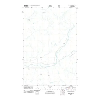
2011 Map of Bunch Lake
USGS Topo · Published 2011About this map
The Quinault River system carves through this Olympic Peninsula landscape, where the North Fork Quinault River joins the main branch near the North Fork Campground. This 2011 survey documents a terrain defined by steep elevation changes, featuring prominent landforms like Paradise Valley and the deeply etched Fletcher Canyon. Water is the primary architect of the region, from the high alpine waters of Reflection Lake and Three Lakes to the eponymous Bunch Lake in the southern portion of the quadrangle. The map reveals an interesting geologic feature labeled as an Underground Passage near Big Creek, suggesting complex drainage patterns. Human infrastructure is minimal, centered largely on North Shore Rd and its connection to the river valleys, reflecting the area's protected and wild character within Grays Harbor County.
Find a feature on this map
19 named features on this map. Tap any name to fly to it.
Don’t see what you’re looking for? This feature index may not catch every label — zoom into the map to look around manually.
Map Details
Editions of this 2011 Bunch Lake Map
This is the sole edition of this map. No revisions or reprints were ever made.
Other maps of this area

1921 · Quinault Lake
USGS Topo · 1:62,500

1921 · Satsop
USGS Topo · 1:62,500

1947 · Mt Christie
USGS Topo · 1:62,500

1950 · Mt Christie
USGS Topo · 1:62,500

1955 · Grisdale
USGS Topo · 1:62,500

1955 · Quinault Lake
USGS Topo · 1:62,500

1956 · Kloochman Rock
USGS Topo · 1:62,500

1958 · Seattle
USGS Topo · 1:250,000

1962 · Seattle
USGS Topo · 1:250,000
1988 · Shelton
USGS Topo · 1:100,000