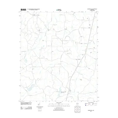
2012 Map of Bunker Hill
USGS Topo · Published 2012About this map
Ebenezer and the community of Bunker Hill anchor this rural Mississippi landscape, which is defined by an exceptional density of family and community burial grounds. The territory is drained by the meandering networks of Holiday Creek, Pierce Creek, and the various forks of Greens Creek. For genealogists, the map is a significant record of local heritage, preserving the locations of numerous historic sites such as Old Bassfield Cemetery, Bunker Hill Memorial Cemetery, and Old Greens Creek Cemetery. A Lookout Tower stands in the northwest, overlooking a terrain partitioned by a network of named country roads and loops, including Hatten Hess Loop and Speights Loop. This 2012 survey illustrates a landscape where the lineage of long-standing families is inscribed directly onto the map through landmarks like Robbins Cemetery and Hathorn Cemetery.
Find a feature on this map
99 named features on this map. Tap any name to fly to it.
Don’t see what you’re looking for? This feature index may not catch every label — zoom into the map to look around manually.
Map Details
Editions of this 2012 Bunker Hill Map
This is the sole edition of this map. No revisions or reprints were ever made.
Other maps of this area

1953 · Hattiesburg
USGS Topo · 1:250,000

1958 · Hattiesburg
USGS Topo · 1:250,000

1970 · Prentiss West
USGS Topo · 1:24,000

1970 · Bunker Hill
USGS Topo · 1:24,000

1970 · Morgantown
USGS Topo · 1:24,000

1970 · Oak Vale
USGS Topo · 1:24,000

1970 · Columbia North
USGS Topo · 1:24,000

1970 · Prentiss East
USGS Topo · 1:24,000

1974 · Bassfield
USGS Topo · 1:24,000

1974 · Lake Mike Connor
USGS Topo · 1:24,000