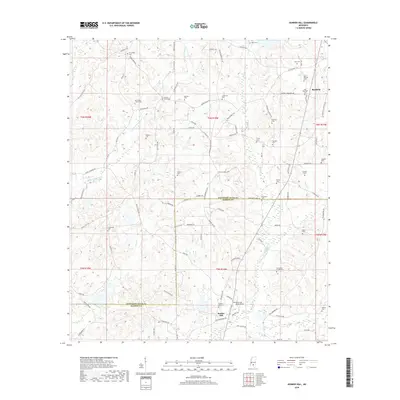
2018 Map of Bunker Hill
USGS Topo · Published 2018About this map
Bassfield and the neighboring community of Bunker Hill anchor this rural landscape in the piney woods of Southern Mississippi. The terrain is defined by a dense network of country roads named for local families, such as Wiley Dyess Rd and T W Bass Rd, indicating a history of generational landholding. The survey captures a high concentration of burial grounds, including the Old Bassfield Cem and Thompson Chapel Cem, which are vital for genealogical research in this part of Jefferson Davis County. Numerous creeks, including Holiday Cr and Pierce Cr, wind through the topography, reflecting a landscape that remains largely defined by its natural drainage patterns and agricultural roots rather than industrial development. The boundary between Jefferson Davis Co and Marion Co bisects the southern portion of the sheet, providing a precise record of late 20th-century geopolitical lines.
Find a feature on this map
95 named features on this map. Tap any name to fly to it.
Don’t see what you’re looking for? This feature index may not catch every label — zoom into the map to look around manually.
Map Details
Editions of this 2018 Bunker Hill Map
This is the sole edition of this map. No revisions or reprints were ever made.
Other maps of this area

1953 · Hattiesburg
USGS Topo · 1:250,000

1958 · Hattiesburg
USGS Topo · 1:250,000

1970 · Prentiss West
USGS Topo · 1:24,000

1970 · Bunker Hill
USGS Topo · 1:24,000

1970 · Morgantown
USGS Topo · 1:24,000

1970 · Oak Vale
USGS Topo · 1:24,000

1970 · Columbia North
USGS Topo · 1:24,000

1970 · Prentiss East
USGS Topo · 1:24,000

1974 · Bassfield
USGS Topo · 1:24,000

1974 · Lake Mike Connor
USGS Topo · 1:24,000