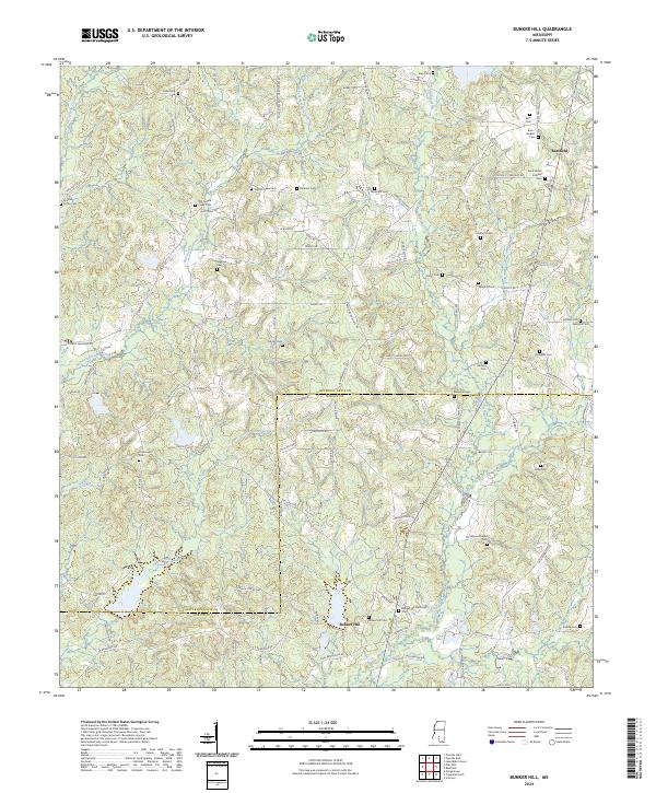
2024 Map of Bunker Hill
USGS Topo · Published 2024About this map
Bassfield and the namesake community of Bunker Hill anchor this rural landscape along the border of Jefferson Davis and Marion counties. The terrain is defined by a dense network of family-named cemeteries and narrow winding roads, reflecting the deep-rooted settlement patterns of south-central Mississippi. Numerous burial grounds such as Saint James Catholic Cem, Bass - Burkett Cem, and Thompson Chapel Cem are scattered across the watershed of Holiday Creek and Pierce Creek. The transition between the West and East Fork Greens Creek creates a distinctive topography where historical property lines and roads like Wiley Dyess Rd and Bass Burkett Rd follow the natural ridges. This modern survey provides an essential reference for genealogists tracing local families whose names remain etched into the landscape through landmarks like Ezekiel Loftin Cem and Hathorn Cem.
Find a feature on this map
100 named features on this map. Tap any name to fly to it.
Don’t see what you’re looking for? This feature index may not catch every label — zoom into the map to look around manually.
Map Details
Editions of this 2024 Bunker Hill Map
This is the sole edition of this map. No revisions or reprints were ever made.
Other maps of this area

1953 · Hattiesburg
USGS Topo · 1:250,000

1958 · Hattiesburg
USGS Topo · 1:250,000

1970 · Prentiss West
USGS Topo · 1:24,000

1970 · Bunker Hill
USGS Topo · 1:24,000

1970 · Morgantown
USGS Topo · 1:24,000

1970 · Oak Vale
USGS Topo · 1:24,000

1970 · Columbia North
USGS Topo · 1:24,000

1970 · Prentiss East
USGS Topo · 1:24,000

1974 · Bassfield
USGS Topo · 1:24,000

1974 · Lake Mike Connor
USGS Topo · 1:24,000