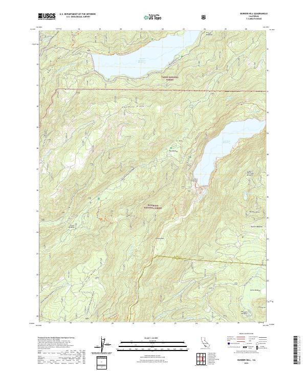
2021 Map of Bunker Hill
USGS Topo · Published 2021About this map
The High Sierra backcountry where Tahoe National Forest meets Eldorado National Forest is defined by deep river canyons and high ridges. The landscape is dominated by the waters of the French Meadows Reservoir to the north and Hell Hole Reservoir to the south, linked by a complex network of forest routes and historic pathways. The legendary Western States Trl and Tevis Cup Trl traverse the northern section near Mosquito Ridge, following terrain that has long challenged travelers through the Middle Fork American River drainage. Southward, the terrain climbs toward Bunker Hill and drops into the Rubicon River canyon, punctuated by high-altitude meadows such as Bunker Meadow and Gerle Meadow. This survey documents a wilderness engineered for recreation and water management, where remote peaks like Wallace Peak stand alongside established forest roads like Mosquito Ridge Rd.
Find a feature on this map
54 named features on this map. Tap any name to fly to it.
Don’t see what you’re looking for? This feature index may not catch every label — zoom into the map to look around manually.
Map Details
Editions of this 2021 Bunker Hill Map
This is the sole edition of this map. No revisions or reprints were ever made.
Other maps of this area

1889 · Pyramid Peak
USGS Topo · 1:125,000

1891 · Colfax
USGS Topo · 1:125,000

1891 · Truckee
USGS Topo · 1:125,000

1891 · Placerville
USGS Topo · 1:125,000

1891 · Pyramid Peak
USGS Topo · 1:125,000

1892 · Placerville
USGS Topo · 1:125,000

1892 · Colfax
USGS Topo · 1:125,000

1893 · Placerville
USGS Topo · 1:125,000

1893 · Truckee
USGS Topo · 1:125,000

1894 · Colfax
USGS Topo · 1:125,000