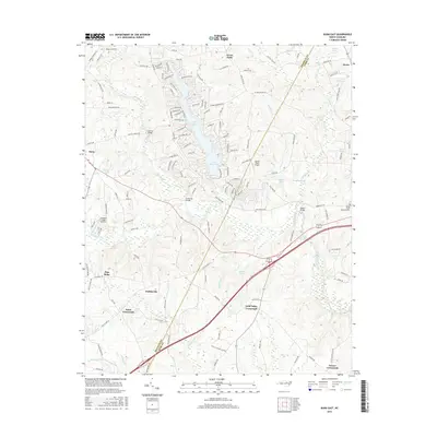
2016 Map of Bunn East
USGS Topo · Published 2016About this map
The Tar River winds through this region of eastern North Carolina, defining the landscape between Bunn and the boundary of Franklin and Nash counties. The area is characterized by a high density of named junctions and small rural settlements, reflecting a deeply rooted community structure. Significant water bodies like Lake Royale and Lake Sagamore provide a contrast to the agricultural and wooded surroundings. Numerous family-named roads and landmarks, including Mullins Bridge and Anderson Bridge, highlight the local history of land ownership and transit across the river's tributaries.
Find a feature on this map
130 named features on this map. Tap any name to fly to it.
Don’t see what you’re looking for? This feature index may not catch every label — zoom into the map to look around manually.
Map Details
Editions of this 2016 Bunn East Map
This is the sole edition of this map. No revisions or reprints were ever made.
Other maps of this area

1902 · Spring Hope
USGS Topo · 1:62,500

1904 · Springhope
USGS Topo · 1:62,500

1953 · Raleigh
USGS Topo · 1:250,000

1953 · Greensboro
USGS Topo · 1:250,000

1954 · Greensboro
USGS Topo · 1:250,000

1954 · Raleigh
USGS Topo · 1:250,000

1962 · Greensboro
USGS Topo · 1:250,000

1966 · Greensboro
USGS Topo · 1:250,000

1968 · Bunn West
USGS Topo · 1:24,000
1968 · Zebulon
USGS Topo · 1:24,000