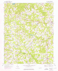
1968 Map of Bunn West
USGS Topo · Published 1975About this map
Moccasin Creek and Norris Creek wind through the undulating countryside of this North Carolina borderland, where the boundary between Franklin Co and Wake Co divides small rural communities. The northeastern corner is anchored by Bunn, a focal point of activity along the Seaboard Coast Line railroad. This landscape is deeply defined by its spiritual and educational centers, including the Union Gospel Tabernacle and Bethlehem Ch, reflecting the area's mid-century social structure.
Find a feature on this map
32 named features on this map. Tap any name to fly to it.
Don’t see what you’re looking for? This feature index may not catch every label — zoom into the map to look around manually.
Map Details
Editions of this 1968 Bunn West Map
2 editions found

Other maps of this area

1902 · Spring Hope
USGS Topo · 1:62,500

1904 · Springhope
USGS Topo · 1:62,500

1953 · Raleigh
USGS Topo · 1:250,000

1953 · Greensboro
USGS Topo · 1:250,000

1954 · Greensboro
USGS Topo · 1:250,000

1954 · Raleigh
USGS Topo · 1:250,000

1962 · Greensboro
USGS Topo · 1:250,000

1966 · Greensboro
USGS Topo · 1:250,000

1967 · Knightdale
USGS Topo · 1:24,000
1967 · Rolesville
USGS Topo · 1:24,000