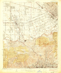
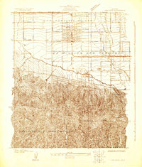
1926 Map of Burbank
USGS Topo · Published 1926About this map
Lankershim and Burbank anchor this mid-1920s survey of the southeast San Fernando Valley, a period when the region's agricultural past was rapidly meeting its cinematic future. The map detail highlights the early footprint of Universal City near the Los Angeles River, while further south, the Hollywood Bowl and Hollywood Lake appear tucked into the foothills of the Santa Monica Mountains. The landscape is dominated by a grid of developing boulevards like Victory Boulevard and Burbank Boulevard, bisected by the Southern Pacific railroad lines that fueled the valley's growth.
Find a feature on this map
44 named features on this map. Tap any name to fly to it.
Don’t see what you’re looking for? This feature index may not catch every label — zoom into the map to look around manually.
Map Details
Editions of this 1926 Burbank Map
3 editions found
Other maps of this area

1894 · Los Angeles
USGS Topo · 1:62,500

1896 · Santa Monica
USGS Topo · 1:62,500

1898 · Santa Monica
USGS Topo · 1:62,500

1900 · Los Angeles
USGS Topo · 1:62,500

1901 · Southern California Sheet No. 1
USGS Topo · 1:250,000

1902 · Santa Monica
USGS Topo · 1:62,500

1904 · Southern California Sheet No. 1
USGS Topo · 1:250,000

1920 · Santa Monica
USGS Topo · 1:62,500
1921 · Santa Monica
USGS Topo · 1:62,500
1924 · Van Nuys
USGS Topo · 1:24,000