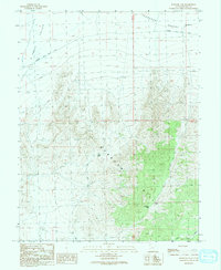
1991 Map of Burbank Pass
USGS Topo · Published 1991About this map
Snake Valley and the western edge of the Ferguson Desert converge in this 1991 provisional survey of Millard County, Utah. The landscape is defined by the prominent Burbank Hills, which are transected by the eponymous Burbank Pass and Red Pass. This map captures a remote desert environment primarily utilized for livestock and resource extraction, evidenced by the presence of Eight-Mile Point Well and a Gravel Pit. The Garrison Black Rock Road serves as the primary corridor through the valley floor, while numerous unnamed prospects and drill holes suggest the geological investigations common to this region during the late twentieth century. Drainage patterns are dominated by the ephemeral Cedar Pass Wash, illustrating the arid hydrology of the Great Basin.
Find a feature on this map
13 named features on this map. Tap any name to fly to it.
Don’t see what you’re looking for? This feature index may not catch every label — zoom into the map to look around manually.
Map Details
Editions of this 1991 Burbank Pass Map
This is the sole edition of this map. No revisions or reprints were ever made.
Other maps of this area

1908 · Fish Springs
USGS Topo · 1:250,000

1910 · Fish Springs
USGS Topo · 1:250,000

1949 · Garrison
USGS Topo · 1:62,500

1951 · Garrison
USGS Topo · 1:62,500

1953 · Richfield
USGS Topo · 1:250,000

1953 · Delta
USGS Topo · 1:250,000

1956 · Lund
USGS Topo · 1:250,000

1956 · Ely
USGS Topo · 1:250,000

1958 · Richfield
USGS Topo · 1:250,000

1958 · Delta
USGS Topo · 1:250,000