Loading...
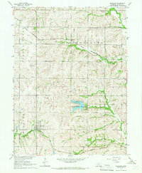
Loading map...1965 Map of Burchard
USGS Topo · Published 1966About this map
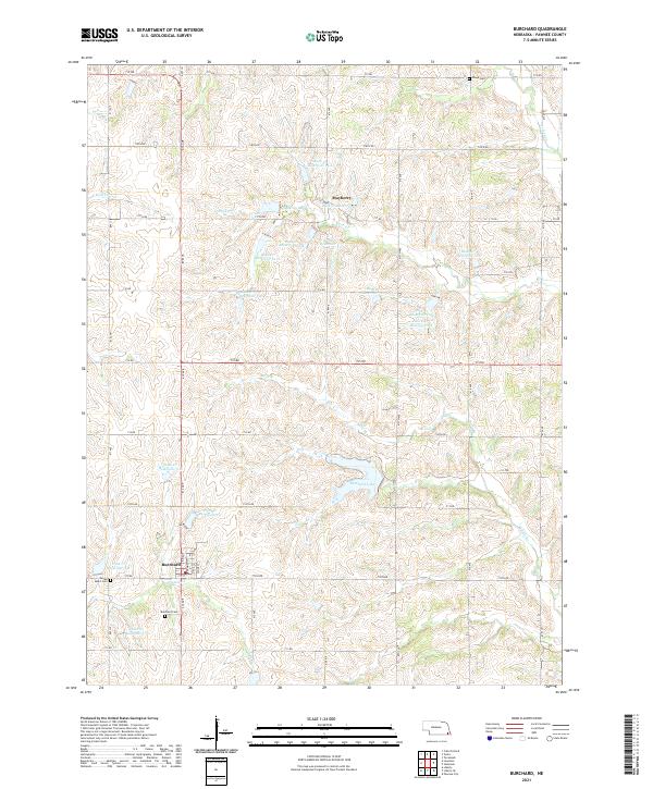
Burchard and Mayberry anchor this mid-1960s Pawnee County landscape, where the agricultural grid is defined by the intersection of major railroads and prairie drainage. The Chicago Rock Island and Pacific runs through the northern half, passing through Mayberry, while the Chicago Burlington and Quincy skirts the south through Burchard. This dual rail presence highlights the area's importance as a shipping corridor for the surrounding farms.
Find a feature on this map
22 named features on this map. Tap any name to fly to it.
Don’t see what you’re looking for? This feature index may not catch every label — zoom into the map to look around manually.
Map Details
Date Portrayed1965
Date Published1966
PublisherU.S. Geological Survey
Map TypeTopographic
Scale1:24,000
Physical Dimensions22.1 x 26.8 inches
Editions of this 1965 Burchard Map
This is the sole edition of this map. No revisions or reprints were ever made.
Historical Maps of Burchard Through Time
5 maps found
Featured Locations
Source Details
SourceU.S. Geological Survey
CopyrightPublic Domain