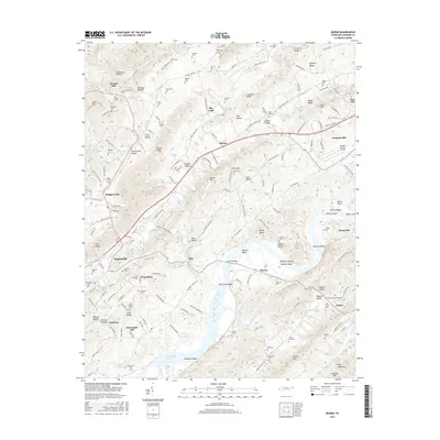
2016 Map of Burem
USGS Topo · Published 2016About this map
Rogersville and the Holston River valley are defined by a complex landscape of ridges and river bends in this mid-2010s survey. The map records the hydrological character of the area, featuring the rare Ebbing and Flowing Spring near Amis, alongside numerous other water sources like Cold Spring and Shanks Spring. The river itself is punctuated by features such as Bussels Bend, Burem Island, and the Big Creek Shoals, illustrating the natural obstacles and landmarks of this Tennessee waterway. Settlement patterns follow the valley floors, with communities like Burem, Surgoinsville, and Striggersville connected by a network of rural roads. Genealogists will find a high density of family-named burial sites, including Looneys Cem, Gillenwater Cem, and Snapp Cem, which provide a clear record of local lineage across the Harlan Knobs and Carter Valley.
Find a feature on this map
184 named features on this map. Tap any name to fly to it.
Don’t see what you’re looking for? This feature index may not catch every label — zoom into the map to look around manually.
Map Details
Editions of this 2016 Burem Map
This is the sole edition of this map. No revisions or reprints were ever made.
Other maps of this area

1883 · Morristown
USGS Topo · 1:125,000

1887 · Jonesville
USGS Topo · 1:125,000

1891 · Jonesville
USGS Topo · 1:125,000

1892 · Greeneville
USGS Topo · 1:125,000

1893 · Morristown
USGS Topo · 1:125,000

1894 · Estillville
USGS Topo · 1:125,000

1895 · Morristown
USGS Topo · 1:125,000

1896 · Greeneville
USGS Topo · 1:125,000

1904 · Greeneville
USGS Topo · 1:125,000

1935 · Surgoinsville
USGS Topo · 1:48,000