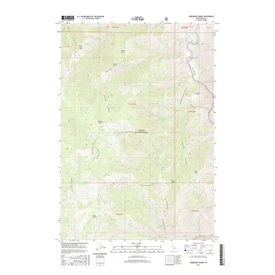
2017 Map of Burgdorf Summit
USGS Topo · Published 2017About this map
Burgdorf Summit and the high mountain passes of Idaho County are meticulously documented in this 2017 survey of the Payette National Forest. The landscape is defined by its dramatic elevation changes and a dense network of watercourses, including the South Fork Salmon River which cuts through the northeastern corner. The map traces the winding paths of Natl Forest Develop Road 355 Rd and the combined corridor of Raines Creek/Slaughter Gulch, illustrating the vital access routes through this timber-rich region. Local landmarks like Faust Meadows and Horse Heaven stand alongside numerous saddles and points, such as Sleepy Saddle and Nelson Point. These features indicate a terrain heavily used for forest management and back-country recreation. Historical survey markers and section lines (T23N R7E) overlay the natural drainages of Smith Cr and Raines Cr, providing a clear grid for locating specific land parcels and topographical high points like Smith Knob.
Find a feature on this map
44 named features on this map. Tap any name to fly to it.
Don’t see what you’re looking for? This feature index may not catch every label — zoom into the map to look around manually.
Map Details
Editions of this 2017 Burgdorf Summit Map
This is the sole edition of this map. No revisions or reprints were ever made.
Other maps of this area

1937 · Big Creek
USGS Topo · 1:48,000

1942 · Big Creek
USGS Topo · 1:62,500

1956 · Warren
USGS Topo · 1:62,500

1956 · Elk City
USGS Topo · 1:250,000

1960 · Elk City
USGS Topo · 1:250,000

1969 · Pony Meadows
USGS Topo · 1:24,000

1969 · Wolf Fang Peak
USGS Topo · 1:24,000

1969 · Pilot Peak
USGS Topo · 1:24,000

1978 · Chicken Peak
USGS Topo · 1:24,000

1979 · Fivemile Bar
USGS Topo · 1:24,000