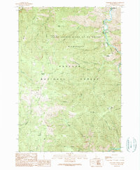
1989 Map of Burgdorf Summit
USGS Topo · Published 1990About this map
Frank Church-River of No Return Wilderness dominates this landscape, showing a high-altitude backcountry in the late 1980s. The terrain is defined by the steep drainage of the South Fork Salmon River and its designated status as the Salmon Wild and Scenic River. Settlement is sparse, restricted to isolated pockets like the Badley Ranch and high meadows such as Faust Meadows. Evidence of early resource extraction persists in the southwest near Slaughter Creek, where several Prospects are recorded. This survey captures a specific moment when the vast Payette National Forest was managed for both wilderness preservation and small-scale land holdings. Critical navigational landmarks for backcountry travelers include Burgdorf Summit and Nelson Point, which rise above a complex network of tributaries including Raines Creek and Smith Creek.
Find a feature on this map
70 named features on this map. Tap any name to fly to it.
Don’t see what you’re looking for? This feature index may not catch every label — zoom into the map to look around manually.
Map Details
Editions of this 1989 Burgdorf Summit Map
This is the sole edition of this map. No revisions or reprints were ever made.
Other maps of this area

1937 · Big Creek
USGS Topo · 1:48,000

1942 · Big Creek
USGS Topo · 1:62,500

1956 · Warren
USGS Topo · 1:62,500

1956 · Elk City
USGS Topo · 1:250,000

1960 · Elk City
USGS Topo · 1:250,000

1969 · Pony Meadows
USGS Topo · 1:24,000

1969 · Wolf Fang Peak
USGS Topo · 1:24,000

1969 · Pilot Peak
USGS Topo · 1:24,000

1978 · Chicken Peak
USGS Topo · 1:24,000

1979 · Fivemile Bar
USGS Topo · 1:24,000