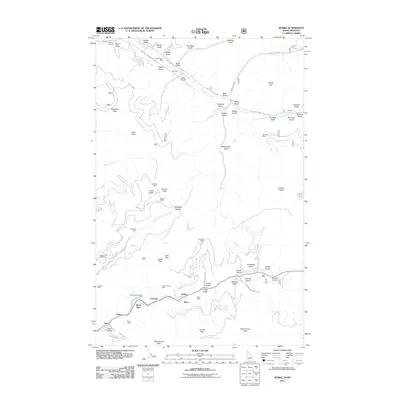
2011 Map of Burke
USGS Topo · Published 2011About this map
Canyon Creek flows through a narrow, industrial canyon that once served as a primary artery for the Silver Valley's mining operations. This landscape is defined by the proximity of industrial sites to small settlements like Burke and Mace, where the steep walls of Tiger Peak and Custer Peak hem in the valley floor. The map documents a complex history of extraction, with numerous named shafts such as the Hercules Mine and the Standard Mammoth Mine dotting the drainages. These operations were connected by high-altitude routes like State Hwy 4 and various forest roads that climb toward Tamarack Saddle. Further north, the terrain shifts toward the drainage of Prichard Creek, near the Murray Cemetery, where the land is scored by dozens of gulches, including Vendetta Gulch and Bonanza Gulch, illustrating the intense geological exploration of the region.
Find a feature on this map
78 named features on this map. Tap any name to fly to it.
Don’t see what you’re looking for? This feature index may not catch every label — zoom into the map to look around manually.
Map Details
Editions of this 2011 Burke Map
This is the sole edition of this map. No revisions or reprints were ever made.
Other maps of this area

1901 · Coeur D'Alene District
USGS Topo · 1:62,500

1903 · Coeur D'Alene District
USGS Topo · 1:62,500

1906 · Coeur D'Alene District
USGS Topo · 1:62,500

1914 · Avery
USGS Topo · 1:125,000

1917 · Avery
USGS Topo · 1:125,000

1932 · Trout Creek
USGS Topo · 1:125,000

1935 · Trout Creek
USGS Topo · 1:125,000

1936 · Trout Creek
USGS Topo · 1:125,000

1956 · Cooper Gulch
USGS Topo · 1:62,500

1956 · Saltese
USGS Topo · 1:62,500