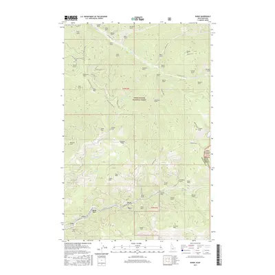
2017 Map of Burke
USGS Topo · Published 2017About this map
The narrow valley of Canyon Creek defines the settlement patterns of this mountain corridor, where the historic mining hamlets of Burke, Mace, Black Bear, Frisco, and Gem are tightly clustered. This high-country landscape is defined by its verticality, with prominent summits such as Tiger Peak, Custer Peak, and Fulkerson Peak towering over a dense network of gulches. The terrain is marked by a complex system of access roads and trails, including Burke Rd and Blue Sky OHV, which navigate the steep drainages feeding into Prichard Creek. Along the eastern boundary, the map shows the transition into the Lolo National Forest at the Montana-Idaho state line. This survey captures a landscape where industry and geography are inseparable, evidenced by the numerous named gulches like Vendetta Gulch and Moonshine Gulch that reflect the region's rugged prospecting history.
Find a feature on this map
72 named features on this map. Tap any name to fly to it.
Don’t see what you’re looking for? This feature index may not catch every label — zoom into the map to look around manually.
Map Details
Editions of this 2017 Burke Map
This is the sole edition of this map. No revisions or reprints were ever made.
Other maps of this area

1901 · Coeur D'Alene District
USGS Topo · 1:62,500

1903 · Coeur D'Alene District
USGS Topo · 1:62,500

1906 · Coeur D'Alene District
USGS Topo · 1:62,500

1914 · Avery
USGS Topo · 1:125,000

1917 · Avery
USGS Topo · 1:125,000

1932 · Trout Creek
USGS Topo · 1:125,000

1935 · Trout Creek
USGS Topo · 1:125,000

1936 · Trout Creek
USGS Topo · 1:125,000

1956 · Cooper Gulch
USGS Topo · 1:62,500

1956 · Saltese
USGS Topo · 1:62,500