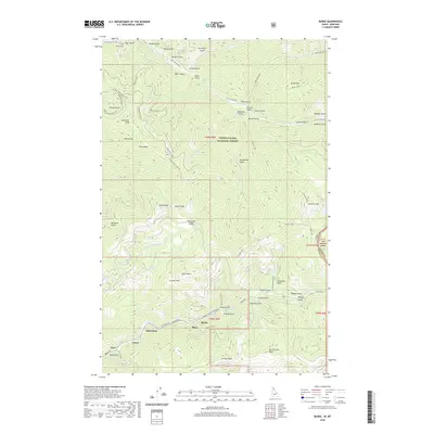
2020 Map of Burke
USGS Topo · Published 2020About this map
Canyon Creek carves a deep valley through the southern portion of this landscape, anchoring a string of historic mining settlements including Burke, Mace, Black Bear, Frisco, and Gem. These narrow canyon floor locations reflect the intense industrial footprint of the Silver Valley, where transport corridors like State Highway 4 and Burke-Canyon Creek Road provide the only passage through steep terrain. Further north, the land rises toward the Idaho-Montana state line, transitioning into the protected reaches of the Coeur d'Alene National Forest and Lolo National Forest. This upper region is defined by a dense network of drainages such as Prichard Creek and Beaver Creek, alongside high-elevation landmarks like Tiger Peak and the remote Revett Lake. The map reveals the balance between concentrated valley industry and the vast, unpopulated mountain ridges that separate these historic mining districts.
Find a feature on this map
75 named features on this map. Tap any name to fly to it.
Don’t see what you’re looking for? This feature index may not catch every label — zoom into the map to look around manually.
Map Details
Editions of this 2020 Burke Map
This is the sole edition of this map. No revisions or reprints were ever made.
Other maps of this area

1901 · Coeur D'Alene District
USGS Topo · 1:62,500

1903 · Coeur D'Alene District
USGS Topo · 1:62,500

1906 · Coeur D'Alene District
USGS Topo · 1:62,500

1914 · Avery
USGS Topo · 1:125,000

1917 · Avery
USGS Topo · 1:125,000

1932 · Trout Creek
USGS Topo · 1:125,000

1935 · Trout Creek
USGS Topo · 1:125,000

1936 · Trout Creek
USGS Topo · 1:125,000

1956 · Cooper Gulch
USGS Topo · 1:62,500

1956 · Saltese
USGS Topo · 1:62,500