
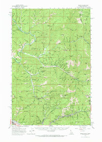
1957 Map of Burke
USGS Topo · Published 1959About this map
Mining operations and narrow canyons dominate this portion of the Bitterroot Range during the late 1950s. The concentrated industrial activity of the Silver Valley is evident in the southeastern quadrant, where the Union Pacific railroad line serves a dense string of settlements including Burke, Mace, Black Bear, and Frisco. Numerous underground operations like the Standard Mammoth Mine and Hercules Mine are flanked by heavy Tailings deposits along the canyon floor. To the north, the landscape shifts toward the drainage of the Coeur d'Alene River and Prichard Creek, where the historic gold mining center of Murray persists near the Golden Chest Mine. The map also captures several remote sites like Littlefield (Site) and Raven (Site), alongside local institutions such as the Beaver School and Shoshone Opportunity Sch, reflecting the community structure that once supported this intense extractive economy.
Find a feature on this map
157 named features on this map. Tap any name to fly to it.
Don’t see what you’re looking for? This feature index may not catch every label — zoom into the map to look around manually.
Map Details
Editions of this 1957 Burke Map
2 editions found
Other maps of this area

1901 · Coeur D'Alene District
USGS Topo · 1:62,500

1903 · Coeur D'Alene District
USGS Topo · 1:62,500

1906 · Coeur D'Alene District
USGS Topo · 1:62,500

1909 · Cataldo
USGS Topo · 1:125,000

1911 · Cataldo
USGS Topo · 1:125,000

1914 · Avery
USGS Topo · 1:125,000

1917 · Avery
USGS Topo · 1:125,000

1932 · Trout Creek
USGS Topo · 1:125,000

1935 · Trout Creek
USGS Topo · 1:125,000

1936 · Trout Creek
USGS Topo · 1:125,000