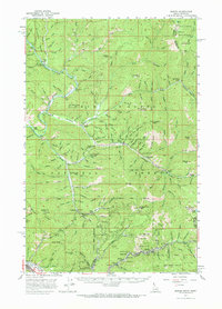
1957 Map of Burke
USGS Topo · Published 1969About this map
The silver-lead mining district of the Coeur d'Alene Mountains is documented here during the late 1950s, showing the intense industrial activity carved into the narrow canyons of Shoshone County. The settlement of Burke is shown squeezed into Canyon Creek alongside a dense concentration of major operations, including the Hercules Mine, Tiger Poorman Mine, and the Standard-Mammoth Mine. To the north, the terrain transitions into the Coeur d'Alene National Forest, where smaller settlements like Murray and Prichard follow the winding course of Prichard Creek. Extensive tailings deposits near Murray and Delta indicate decades of hydraulic and placer mining. This survey highlights the complex infrastructure of a high-altitude mining economy, from the Little Baldy Lookout to the Shoshone Opportunity Sch near Osburn.
Find a feature on this map
140 named features on this map. Tap any name to fly to it.
Don’t see what you’re looking for? This feature index may not catch every label — zoom into the map to look around manually.
Map Details
Editions of this 1957 Burke Map
2 editions found

Other maps of this area

1901 · Coeur D'Alene District
USGS Topo · 1:62,500

1903 · Coeur D'Alene District
USGS Topo · 1:62,500

1906 · Coeur D'Alene District
USGS Topo · 1:62,500

1909 · Cataldo
USGS Topo · 1:125,000

1911 · Cataldo
USGS Topo · 1:125,000

1914 · Avery
USGS Topo · 1:125,000

1917 · Avery
USGS Topo · 1:125,000

1932 · Trout Creek
USGS Topo · 1:125,000

1935 · Trout Creek
USGS Topo · 1:125,000

1936 · Trout Creek
USGS Topo · 1:125,000