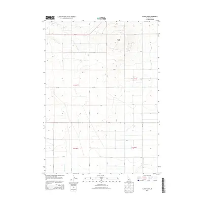
2013 Map of Burley Butte
USGS Topo · Published 2013About this map
Burley Butte rises as the central landmark in this high desert landscape south of the Snake River. The terrain is defined by a rigorous grid of section lines and irrigation roads, reflecting the agricultural development of southern Idaho's Snake River Plain. Water management is evident through the courses of Goose Cr and Big Cottonwood Cr in the southern reaches of the quadrangle. Transport through the northern section is anchored by Us-30 E, following a historic corridor that has long connected the regional agricultural hubs. The map captures the geometric precision of the Public Land Survey System, showing the township boundaries of t11s r21e, t11s r22e, t12s r21e, and t12s r22e as they partition the Cassia County countryside.
Find a feature on this map
18 named features on this map. Tap any name to fly to it.
Don’t see what you’re looking for? This feature index may not catch every label — zoom into the map to look around manually.
Map Details
Editions of this 2013 Burley Butte Map
This is the sole edition of this map. No revisions or reprints were ever made.
Other maps of this area

1954 · Pocatello
USGS Topo · 1:250,000

1955 · Twin Falls
USGS Topo · 1:250,000

1958 · Twin Falls
USGS Topo · 1:250,000

1958 · Pocatello
USGS Topo · 1:250,000

1964 · Burley SW
USGS Topo · 1:24,000

1964 · Kenyon
USGS Topo · 1:24,000

1964 · Milner
USGS Topo · 1:24,000

1964 · Burley Butte
USGS Topo · 1:24,000

1964 · Burley SE
USGS Topo · 1:24,000

1965 · Milner Butte
USGS Topo · 1:24,000