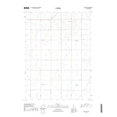
2020 Map of Burley Butte
USGS Topo · Published 2020About this map
Burley Butte rises as the dominant landmark in this high-desert landscape of Cassia County. The survey illustrates a meticulous grid of rural roads and section lines that define the agricultural and pastoral divisions of the region. Water sources are vital but sparse, with the drainage of Big Cottonwood Cr and Goose Cr carving subtle paths through the terrain. The map's layout, dominated by township and range markers like t11s r21e and t12s r22e, reflects the systematic land management of southern Idaho. Local travel is facilitated by a strictly organized network including 800 West Rd and 900 South Rd, which connect the scattered homesteads and ranch lands across this portion of the Snake River Plain periphery.
Find a feature on this map
28 named features on this map. Tap any name to fly to it.
Don’t see what you’re looking for? This feature index may not catch every label — zoom into the map to look around manually.
Map Details
Editions of this 2020 Burley Butte Map
This is the sole edition of this map. No revisions or reprints were ever made.
Other maps of this area

1954 · Pocatello
USGS Topo · 1:250,000

1955 · Twin Falls
USGS Topo · 1:250,000

1958 · Twin Falls
USGS Topo · 1:250,000

1958 · Pocatello
USGS Topo · 1:250,000

1964 · Burley SW
USGS Topo · 1:24,000

1964 · Kenyon
USGS Topo · 1:24,000

1964 · Milner
USGS Topo · 1:24,000

1964 · Burley Butte
USGS Topo · 1:24,000

1964 · Burley SE
USGS Topo · 1:24,000

1965 · Milner Butte
USGS Topo · 1:24,000