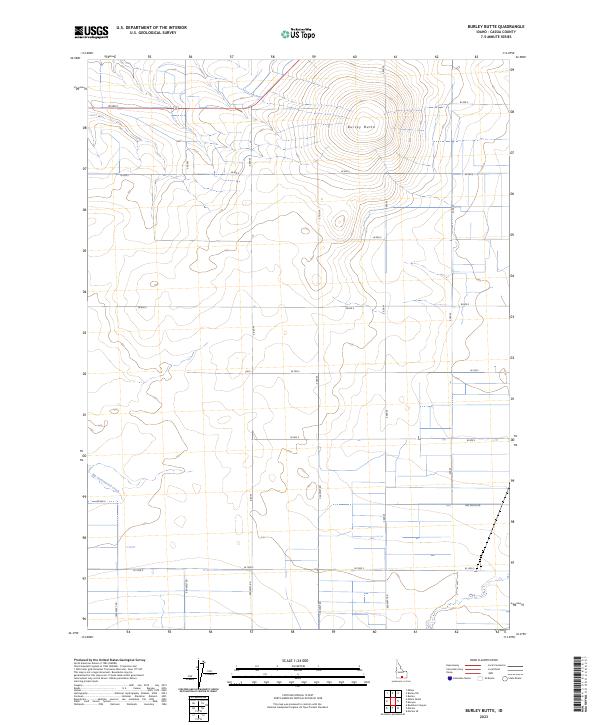
2023 Map of Burley Butte
USGS Topo · Published 2023About this map
Burley Butte dominates the northeastern portion of this Idaho landscape, where the terrain transitions from the high ground of the butte into a highly organized agricultural grid. The map reveals a strictly surveyed rural environment defined by the Public Land Survey System, with the intersection of t11s r21e, t11s r22e, t12s r21e, and t12s r22e meeting at the center of a dense network of country roads. Water distribution and natural drainage are central to the area's layout, most notably where Big Cottonwood Creek meanders through the southern sections. The transition from named roads like 900 South Rd to a strict numerical grid system of western and southern coordinates illustrates a landscape optimized for modern ranching and farming in Cassia County.
Find a feature on this map
25 named features on this map. Tap any name to fly to it.
Don’t see what you’re looking for? This feature index may not catch every label — zoom into the map to look around manually.
Map Details
Editions of this 2023 Burley Butte Map
This is the sole edition of this map. No revisions or reprints were ever made.
Other maps of this area

1954 · Pocatello
USGS Topo · 1:250,000

1955 · Twin Falls
USGS Topo · 1:250,000

1958 · Twin Falls
USGS Topo · 1:250,000

1958 · Pocatello
USGS Topo · 1:250,000

1964 · Burley SW
USGS Topo · 1:24,000

1964 · Kenyon
USGS Topo · 1:24,000

1964 · Milner
USGS Topo · 1:24,000

1964 · Burley Butte
USGS Topo · 1:24,000

1964 · Burley SE
USGS Topo · 1:24,000

1965 · Milner Butte
USGS Topo · 1:24,000