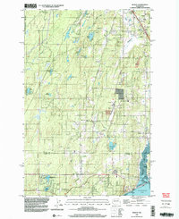
1999 Map of Burley
USGS Topo · Published 2003About this map
The Key Peninsula and the southernmost reaches of Kitsap County are defined by a complex network of glacial lakes and coastal inlets at the turn of the millennium. The settlement of Burley serves as a focal point near the head of Burley Lagoon, where the local Burley-Glenwood Sch marks the community center. To the south, the landscape transitions into Pierce County at Purdy and Wauna, where the waters of Henderson Bay dominate the geography.
Find a feature on this map
54 named features on this map. Tap any name to fly to it.
Don’t see what you’re looking for? This feature index may not catch every label — zoom into the map to look around manually.
Map Details
Editions of this 1999 Burley Map
This is the sole edition of this map. No revisions or reprints were ever made.
Other maps of this area

1936 · Point Misery
USGS Topo · 1:62,500

1937 · Port Orchard
USGS Topo · 1:62,500

1938 · Allyn
USGS Topo · 1:62,500

1940 · Point Misery
USGS Topo · 1:62,500

1942 · Gig Harbor
USGS Topo · 1:62,500

1943 · Gig Harbor
USGS Topo · 1:62,500

1953 · Burley
USGS Topo · 1:24,000

1953 · Sylvan
USGS Topo · 1:24,000

1953 · Vaughn
USGS Topo · 1:24,000

1953 · Bremerton West
USGS Topo · 1:24,000