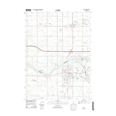
2013 Map of Burley
USGS Topo · Published 2013About this map
The Snake River winds through the heart of this Southern Idaho landscape, marking the boundary between Minidoka and Cassia counties. In the early 21st century, the city of Burley serves as a major hub, its grid extending toward the riverbanks and the Burley Municipal Airport. Across the water, the community of Heyburn is linked by bridges near Hog Island, while the smaller settlements of Paul, Myers, and Budge dot the northern agricultural plains.
Find a feature on this map
168 named features on this map. Tap any name to fly to it.
Don’t see what you’re looking for? This feature index may not catch every label — zoom into the map to look around manually.
Map Details
Editions of this 2013 Burley Map
This is the sole edition of this map. No revisions or reprints were ever made.
Other maps of this area

1954 · Pocatello
USGS Topo · 1:250,000

1958 · Pocatello
USGS Topo · 1:250,000

1964 · Burley SW
USGS Topo · 1:24,000

1964 · Burley NE
USGS Topo · 1:24,000

1964 · View
USGS Topo · 1:24,000

1964 · Kenyon
USGS Topo · 1:24,000

1964 · Rupert NW
USGS Topo · 1:24,000

1964 · Burley NW
USGS Topo · 1:24,000

1964 · Burley Butte
USGS Topo · 1:24,000

1964 · Rupert SW
USGS Topo · 1:24,000