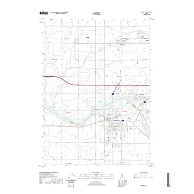
2020 Map of Burley
USGS Topo · Published 2020About this map
The Snake River carves a path through the southern Idaho landscape, separating Burley in Cassia County from Heyburn in Minidoka County. This 2020 map documents the intricate water management system essential to the region's agricultural character, featuring an extensive network of infrastructure such as the C Canal, G Canal, and G 16 Lateral. Islands such as Hog Island, Goat Island, and Crow Island are caught in the river's flow, while the city of Burley serves as a central hub, containing the Cassia County Judicial Center and Burley Municipal Airport. Local history and genealogy are preserved through the locations of Gem Memorial Cem and Pleasant View Cem. The survey also tracks smaller settlements and sidings like Budge, Paul, Ruby, and Myers, providing a detailed look at the rural-to-urban transition along the Interstate 84 corridor.
Find a feature on this map
79 named features on this map. Tap any name to fly to it.
Don’t see what you’re looking for? This feature index may not catch every label — zoom into the map to look around manually.
Map Details
Editions of this 2020 Burley Map
This is the sole edition of this map. No revisions or reprints were ever made.
Other maps of this area

1954 · Pocatello
USGS Topo · 1:250,000

1958 · Pocatello
USGS Topo · 1:250,000

1964 · Burley SW
USGS Topo · 1:24,000

1964 · Burley NE
USGS Topo · 1:24,000

1964 · View
USGS Topo · 1:24,000

1964 · Kenyon
USGS Topo · 1:24,000

1964 · Rupert NW
USGS Topo · 1:24,000

1964 · Burley NW
USGS Topo · 1:24,000

1964 · Burley Butte
USGS Topo · 1:24,000

1964 · Rupert SW
USGS Topo · 1:24,000