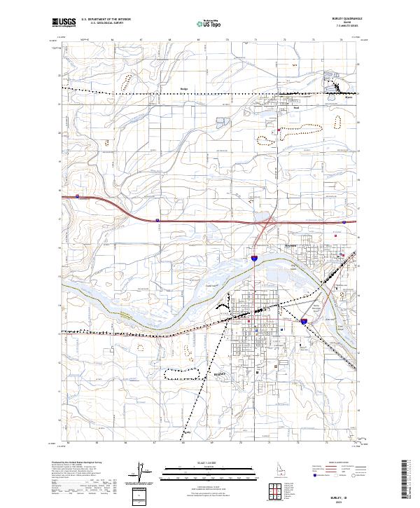
2023 Map of Burley
USGS Topo · Published 2023About this map
The Snake River carves through this agricultural corridor, defining the boundary between Minidoka and Cassia counties. The city of Burley serves as the regional hub, characterized by a dense grid of residential and commercial streets south of the river, while Heyburn sits directly opposite on the north bank. This landscape is a complex network of man-made irrigation, where the Main Drain, C Canal, and numerous laterals like G 14 Lateral support the surrounding farmland. The presence of multiple river islands, including Custer Island, Hog Island, and Goat Island, reveals the shifting nature of the waterway. Notable local landmarks such as the Burley Municipal Airport and the Cassia County Judicial Center anchor the town, while outlying settlements like Paul and Budge mark the periphery of this productive river valley.
Find a feature on this map
113 named features on this map. Tap any name to fly to it.
Don’t see what you’re looking for? This feature index may not catch every label — zoom into the map to look around manually.
Map Details
Editions of this 2023 Burley Map
This is the sole edition of this map. No revisions or reprints were ever made.
Other maps of this area

1954 · Pocatello
USGS Topo · 1:250,000

1958 · Pocatello
USGS Topo · 1:250,000

1964 · Burley SW
USGS Topo · 1:24,000

1964 · Burley NE
USGS Topo · 1:24,000

1964 · View
USGS Topo · 1:24,000

1964 · Kenyon
USGS Topo · 1:24,000

1964 · Rupert NW
USGS Topo · 1:24,000

1964 · Burley NW
USGS Topo · 1:24,000

1964 · Burley Butte
USGS Topo · 1:24,000

1964 · Rupert SW
USGS Topo · 1:24,000