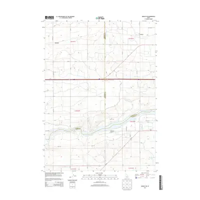
2013 Map of Burley SW
USGS Topo · Published 2013About this map
The Snake River carves through this Southern Idaho landscape, marking the intersection of Jerome, Minidoka, and Cassia counties. This high-desert agricultural region is defined by a sophisticated water management network, evidenced by prominent features like the S Main Drain, J Canal, and numerous irrigation laterals such as G 20 Lateral. The mapping of these water systems illustrates the transformation of the Snake River Plain into a productive farming district. Small agricultural hubs and farmsteads like Schodde, Hobson, and Lakeview Farm anchor the rural landscape.
Find a feature on this map
34 named features on this map. Tap any name to fly to it.
Don’t see what you’re looking for? This feature index may not catch every label — zoom into the map to look around manually.
Map Details
Editions of this 2013 Burley SW Map
This is the sole edition of this map. No revisions or reprints were ever made.
Other maps of this area

1954 · Pocatello
USGS Topo · 1:250,000

1955 · Twin Falls
USGS Topo · 1:250,000

1958 · Twin Falls
USGS Topo · 1:250,000

1958 · Pocatello
USGS Topo · 1:250,000

1964 · Burley SW
USGS Topo · 1:24,000

1964 · Burley NE
USGS Topo · 1:24,000

1964 · Kenyon
USGS Topo · 1:24,000

1964 · Burley NW
USGS Topo · 1:24,000

1964 · Milner
USGS Topo · 1:24,000

1964 · Hazelton NE
USGS Topo · 1:24,000