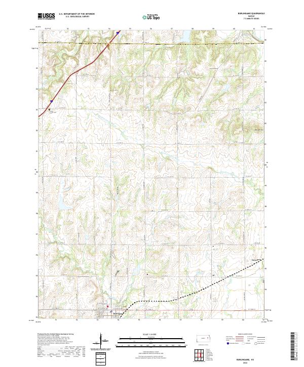
2022 Map of Burlingame
USGS Topo · Published 2022About this map
Burlingame and Scranton serve as the primary population centers on this modern Kansas landscape, situated where the northern Osage County line meets Shawnee County. The topography is defined by the winding course of the Wakarusa River and South Wakarusa River in the north, while the southern reaches are drained by Hundred and Ten Mile Cr and Switzler Cr. This network of waterways creates a rolling terrain punctuated by landmarks like Stenger Hill and smaller tributaries such as Hoover Br. Local history is preserved at the Prairie Center Cem located west of the main settlements. The township and range system grid, including t14s r14e and t14s r15e, dictates the modern road network, which still follows the historic section lines that have shaped Kansas agriculture and travel for generations.
Find a feature on this map
52 named features on this map. Tap any name to fly to it.
Don’t see what you’re looking for? This feature index may not catch every label — zoom into the map to look around manually.
Map Details
Editions of this 2022 Burlingame Map
This is the sole edition of this map. No revisions or reprints were ever made.
Other maps of this area

1889 · Burlingame
USGS Topo · 1:125,000

1894 · Burlingame
USGS Topo · 1:125,000

1947 · Lawrence
USGS Topo · 1:250,000

1950 · Lawrence
USGS Topo · 1:250,000

1952 · Auburn
USGS Topo · 1:24,000

1952 · Harveyville
USGS Topo · 1:24,000
1952 · Dover
USGS Topo · 1:24,000

1952 · Burlingame
USGS Topo · 1:24,000
1955 · Wakarusa
USGS Topo · 1:24,000

1955 · Carbondale
USGS Topo · 1:24,000