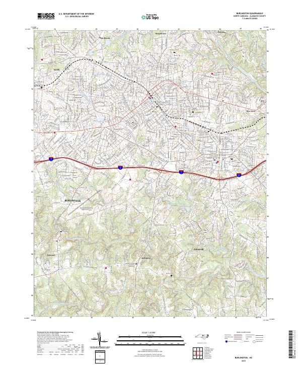
2023 Map of Burlington
USGS Topo · Published 2023About this map
Burlington and the adjacent city of Graham serve as the central hubs for this region of the Piedmont, where the landscape is defined by the winding paths of Big Alamance Creek and the Haw River. The area reflects a transition from early milling settlements like Hopedale and Alamance to a modern transportation corridor centered around the Alamance County Courthouse. Genealogists will find significant value in the detailed plotting of numerous burial grounds, including the Providence Church Cem and the Episcopal Church of Holy Comforter Cem, which anchor the local community history.
Find a feature on this map
431 named features on this map. Tap any name to fly to it.
Don’t see what you’re looking for? This feature index may not catch every label — zoom into the map to look around manually.
Map Details
Editions of this 2023 Burlington Map
This is the sole edition of this map. No revisions or reprints were ever made.
Other maps of this area

1953 · Raleigh
USGS Topo · 1:250,000

1953 · Greensboro
USGS Topo · 1:250,000

1954 · Greensboro
USGS Topo · 1:250,000

1954 · Raleigh
USGS Topo · 1:250,000

1962 · Greensboro
USGS Topo · 1:250,000

1966 · Greensboro
USGS Topo · 1:250,000

1969 · Burlington
USGS Topo · 1:24,000

1969 · Mebane
USGS Topo · 1:24,000

1969 · Lake Burlington
USGS Topo · 1:24,000

1969 · Burlington NE
USGS Topo · 1:24,000