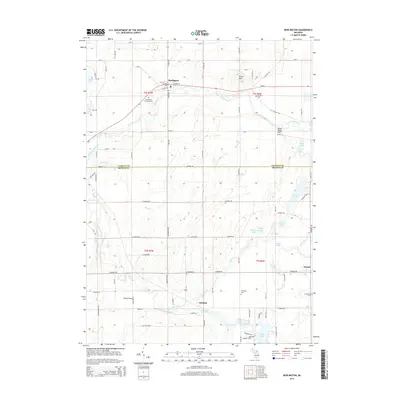
2014 Map of Burlington
USGS Topo · Published 2014About this map
Burlington sits at the northern edge of this Michigan landscape, where the Saint Joseph River meanders through Calhoun and Branch Counties. The river system, including the Coldwater River and Burnett Cr, shapes a region defined by its numerous small glacial basins, such as Hubbard Lake, Vincent Lake, and Musser Lake. Small settlements like Girard and Hodunk anchor the rural crossroads, reflecting a long-standing agricultural and township structure. Local history is traced through several burial grounds, including the Burlington Township Cem and Windfall Cem. To the south, the topography descends toward Hodunk Pond and Craig Lake, while Stony Point Hill provides one of the few prominent elevation markers in an area otherwise characterized by steady watercourses and a dense network of numbered mile roads and county routes like M 60 E.
Find a feature on this map
94 named features on this map. Tap any name to fly to it.
Don’t see what you’re looking for? This feature index may not catch every label — zoom into the map to look around manually.
Map Details
Editions of this 2014 Burlington Map
This is the sole edition of this map. No revisions or reprints were ever made.
Other maps of this area

1918 · Union City
USGS Topo · 1:62,500

1947 · Union City
USGS Topo · 1:62,500

1948 · Homer
USGS Topo · 1:62,500

1949 · Homer
USGS Topo · 1:62,500

1950 · Union City
USGS Topo · 1:62,500

1953 · Fort Wayne
USGS Topo · 1:250,000

1956 · Fort Wayne
USGS Topo · 1:250,000

1958 · Grand Rapids
USGS Topo · 1:250,000

1960 · Coldwater West
USGS Topo · 1:24,000

1960 · Coldwater East
USGS Topo · 1:24,000