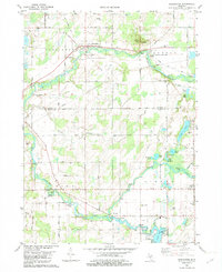
1982 Map of Burlington
USGS Topo · Published 1982About this map
The St Joseph River meanders through this portion of southern Michigan, where the village of Burlington sits at a historic crossing. This 1982 map details the transition from the lowlands of the Coldwater River to the upland terrain of Dixon Hill and Stony Point Hill. The landscape is a network of small glacial lakes and marshes, including Vincent Lake, Hubbard Lake, and Craig Lake.
Find a feature on this map
74 named features on this map. Tap any name to fly to it.
Don’t see what you’re looking for? This feature index may not catch every label — zoom into the map to look around manually.
Map Details
Editions of this 1982 Burlington Map
This is the sole edition of this map. No revisions or reprints were ever made.
Other maps of this area

1918 · Union City
USGS Topo · 1:62,500

1947 · Union City
USGS Topo · 1:62,500

1948 · Homer
USGS Topo · 1:62,500

1949 · Homer
USGS Topo · 1:62,500

1950 · Union City
USGS Topo · 1:62,500

1953 · Fort Wayne
USGS Topo · 1:250,000

1956 · Fort Wayne
USGS Topo · 1:250,000

1958 · Grand Rapids
USGS Topo · 1:250,000

1960 · Coldwater West
USGS Topo · 1:24,000

1960 · Coldwater East
USGS Topo · 1:24,000