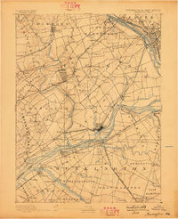
1893 Map of Burlington
USGS Topo · Published 1898About this map
Delaware River navigation and industrial power drive the landscape of this late-nineteenth-century survey of the Pennsylvania-New Jersey border. Significant hydraulic engineering is evident near the river's bend, including the Delaware and Raritan Canal Feeder, the Pennsylvania Canal, and the Trenton Water Power Mill Race. These waterworks supported early manufacturing alongside the growing rail networks of the Pennsylvania Railroad and Reading Railroad.
Find a feature on this map
122 named features on this map. Tap any name to fly to it.
Don’t see what you’re looking for? This feature index may not catch every label — zoom into the map to look around manually.
Map Details
Editions of this 1893 Burlington Map
3 editions found

Other maps of this area

1888 · Bordentown
USGS Topo · 1:62,500

1888 · Pemberton
USGS Topo · 1:62,500

1888 · Mount Holly
USGS Topo · 1:62,500

1888 · Princeton
USGS Topo · 1:62,500

1890 · Lambertville
USGS Topo · 1:62,500

1890 · Doylestown
USGS Topo · 1:62,500

1890 · Burlington
USGS Topo · 1:62,500

1891 · Lambertville
USGS Topo · 1:62,500

1891 · Doylestown
USGS Topo · 1:62,500

1891 · Philadelphia
USGS Topo · 1:62,500