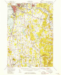
1948 Map of Burlington
USGS Topo · Published 1954About this map
Burlington anchors the eastern shore of Lake Champlain in this mid-century survey, showing a landscape defined by the transition from urban industry to rural Champlain Valley foothills. The city's waterfront is marked by Gas Tanks and a Beacon Light, while the University of Vermont dominates the heights overlooking the lake. Further inland, the Winooski River carves a dramatic path through Winooski and Essex Junction, serving as a corridor for the Central Vermont and Rutland RR lines.
Find a feature on this map
108 named features on this map. Tap any name to fly to it.
Don’t see what you’re looking for? This feature index may not catch every label — zoom into the map to look around manually.
Map Details
Editions of this 1948 Burlington Map
4 editions found
Other maps of this area

1894 · Port Henry
USGS Topo · 1:62,500

1894 · Plattsburg
USGS Topo · 1:62,500

1895 · Willsboro
USGS Topo · 1:62,500

1898 · Port Henry
USGS Topo · 1:62,500

1903 · Middlebury
USGS Topo · 1:62,500

1905 · Middlebury
USGS Topo · 1:62,500

1906 · Plattsburg
USGS Topo · 1:62,500

1906 · Burlington
USGS Topo · 1:62,500

1913 · Milton
USGS Topo · 1:48,000

1915 · Milton
USGS Topo · 1:62,500