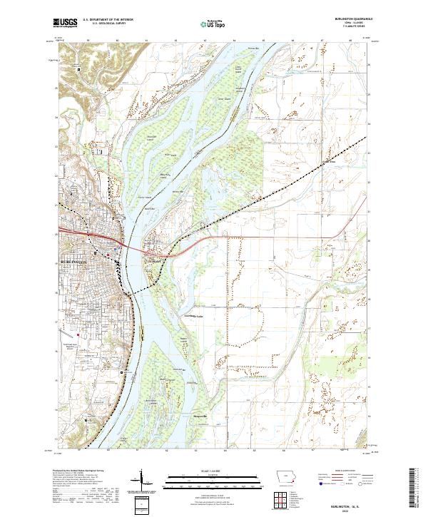
2022 Map of Burlington
USGS Topo · Published 2022About this map
The Mississippi River forms the central character of this 2022 survey, acting as the state boundary between Burlington, Iowa, and the lowlands of Illinois. The map documents the intricate riverine landscape of the mid-21st century, where the main channel is flanked by a complex system of side-channels and islands including O'Connell Slough, Rush Chute, and Burlington Island. On the Iowa side, the dense street grid of the city climbs away from the river, centered on the Des Moines County Courthouse and extending past the expansive Aspen Grove Cem. Local family history is uniquely preserved through the inclusion of several private burial grounds such as the Meyers Family Plot, Cowles Farm Plot, and Prugh Farm Plot. To the south, the Southeast Iowa Regional Airport occupies the plateau, while across the water in Illinois, the landscape shifts to a network of drainage ditches like the Ellison Creek Diverson Ditch and backwater features like Carthage Lake.
Find a feature on this map
174 named features on this map. Tap any name to fly to it.
Don’t see what you’re looking for? This feature index may not catch every label — zoom into the map to look around manually.
Map Details
Editions of this 2022 Burlington Map
This is the sole edition of this map. No revisions or reprints were ever made.
Other maps of this area

1918 · La Harpe
USGS Topo · 1:62,500

1932 · Lomax
USGS Topo · 1:62,500

1934 · Oquawka
USGS Topo · 1:48,000

1934 · Burlington
USGS Topo · 1:48,000

1937 · Lomax
USGS Topo · 1:62,500

1940 · Oquawka
USGS Topo · 1:62,500

1940 · Burlington
USGS Topo · 1:62,500

1958 · Burlington
USGS Topo · 1:250,000

1961 · Burlington
USGS Topo · 1:250,000

1963 · Burlington
USGS Topo · 1:250,000