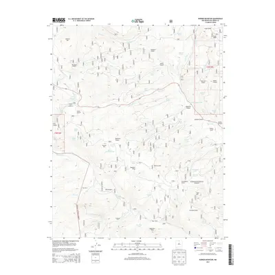
2013 Map of Burned Mountain
USGS Topo · Published 2013About this map
Carson National Forest terrain defines this high-elevation landscape, where the headwaters of the Rio Tusas and Rio Vallecitos carve through the mountains of Rio Arriba County. The presence of livestock ranching and timber management is evident through scattered markers like Bone Ranch and El Vallecito Ranch, along with numerous named tanks and springs used for water management in this arid environment. Significant peaks such as Jawbone Mtn, Burned Mtn, and Tusas Mtn anchor the topography, providing a look at the wilderness character of the Tusas Ridge area. Recreational infrastructure is centered around Hopewell Lake, including the Hopewell Lake Campground and several mountain parks like Sullivan Park and Deer Park. This 2013 survey provides an inventory of the forest road system, including Route 64 and various forest service routes that connect these remote canyons and ridges.
Find a feature on this map
65 named features on this map. Tap any name to fly to it.
Don’t see what you’re looking for? This feature index may not catch every label — zoom into the map to look around manually.
Map Details
Editions of this 2013 Burned Mountain Map
This is the sole edition of this map. No revisions or reprints were ever made.
Other maps of this area

1918 · Tusas
USGS Topo · 1:125,000

1954 · Aztec
USGS Topo · 1:250,000

1955 · Cebolla
USGS Topo · 1:62,500

1955 · Brazos Peak
USGS Topo · 1:62,500

1958 · Aztec
USGS Topo · 1:250,000

1962 · Aztec
USGS Topo · 1:250,000
1963 · Las Tablas
USGS Topo · 1:24,000

1963 · Broke Off Mountain
USGS Topo · 1:24,000

1963 · Burned Mountain
USGS Topo · 1:24,000
1963 · San Antonio Mountain
USGS Topo · 1:24,000