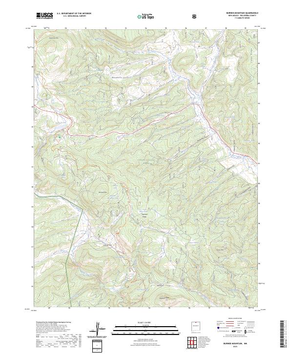
2023 Map of Burned Mountain
USGS Topo · Published 2023About this map
Carson National Forest encompasses this high-elevation landscape in the mountains of Northern New Mexico, where the continental divide marks a significant hydrological boundary. The headwaters of the Rio Tusas and Rio Vallecitos drain the surrounding peaks, including Tusas Mtn and Jawbone Mtn. This area has long served as a corridor for movement, documented here by the modern Continental Divide National Scenic Trail and the Tony Marquez Trl. At the center of the sheet, Hopewell Lake and Hopewell Ridge provide landmarks within a terrain defined by deep incisions like Buckhorn Canyon and Duran Canyon. The map reveals a land managed for its natural resources and recreational value, scattered with numerous stock tanks and springs such as Moeller Spring and Butterfly Spring, which support the high-country grazing lands of Sullivan Park and Deer Park.
Find a feature on this map
56 named features on this map. Tap any name to fly to it.
Don’t see what you’re looking for? This feature index may not catch every label — zoom into the map to look around manually.
Map Details
Editions of this 2023 Burned Mountain Map
This is the sole edition of this map. No revisions or reprints were ever made.
Other maps of this area

1918 · Tusas
USGS Topo · 1:125,000

1954 · Aztec
USGS Topo · 1:250,000

1955 · Cebolla
USGS Topo · 1:62,500

1955 · Brazos Peak
USGS Topo · 1:62,500

1958 · Aztec
USGS Topo · 1:250,000

1962 · Aztec
USGS Topo · 1:250,000
1963 · Las Tablas
USGS Topo · 1:24,000

1963 · Broke Off Mountain
USGS Topo · 1:24,000

1963 · Burned Mountain
USGS Topo · 1:24,000
1963 · San Antonio Mountain
USGS Topo · 1:24,000