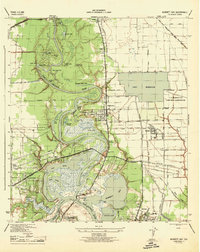
1944 Map of Burnett Bay
USGS Topo · Published 1944About this map
The San Jacinto River meanders through a complex landscape of coastal bayous and cypress lakes just before the Second World War. This 1944 edition, mapped by the Tennessee Valley Authority for the Corps of Engineers, captures the industrial and agricultural transition of Eastern Harris County. The historic crossing at Lynchburg and the nearby San Jacinto State Park anchor the southern portion of the sheet, while the emerging communities of Highlands, McNair, and Channelview show the early suburbanization following the rail lines of the Missouri Pacific and Southern Pacific.
Find a feature on this map
71 named features on this map. Tap any name to fly to it.
Don’t see what you’re looking for? This feature index may not catch every label — zoom into the map to look around manually.
Map Details
Editions of this 1944 Burnett Bay Map
This is the sole edition of this map. No revisions or reprints were ever made.
Other maps of this area

1915 · Deepwater
USGS Topo · 1:24,000

1916 · Burnett Bay
USGS Topo · 1:24,000

1916 · Crosby
USGS Topo · 1:24,000

1916 · Morgan Point
USGS Topo · 1:24,000

1916 · Fauna
USGS Topo · 1:24,000

1916 · Harmaston
USGS Topo · 1:24,000

1916 · Cedar Bayou
USGS Topo · 1:24,000

1916 · La Porte
USGS Topo · 1:24,000

1919 · Morgan Point
USGS Topo · 1:31,680

1919 · Deepwater
USGS Topo · 1:31,680