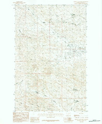
1984 Map of Burnett Flats West
USGS Topo · Published 1984About this map
Burnett Flats dominates the eastern portion of this landscape in Valley County, where the high plains are deeply incised by a complex network of coulees and intermittent streams. This 1980s drainage pattern reflects a region managed for water scarcity, evidenced by the strategic placement of man-made catchments like Badger Reservoir, Somers Reservoir, and John Reservoir. These water sources are critical to the local geography, situated near the headwaters of the South Fork Little Beaver Creek and Lone Tree Creek.
Find a feature on this map
15 named features on this map. Tap any name to fly to it.
Don’t see what you’re looking for? This feature index may not catch every label — zoom into the map to look around manually.
Map Details
Editions of this 1984 Burnett Flats West Map
This is the sole edition of this map. No revisions or reprints were ever made.
Other maps of this area

1954 · Jordan
USGS Topo · 1:250,000

1954 · Glasgow
USGS Topo · 1:250,000

1956 · Jordan
USGS Topo · 1:250,000

1957 · Glasgow
USGS Topo · 1:250,000

1958 · Glasgow
USGS Topo · 1:250,000

1958 · Jordan
USGS Topo · 1:250,000

1964 · Jordan
USGS Topo · 1:250,000
1973 · Triple Crossing Reservoir East
USGS Topo · 1:24,000

1973 · Triple Crossing Reservoir West
USGS Topo · 1:24,000

1973 · Niles Coulee
USGS Topo · 1:24,000