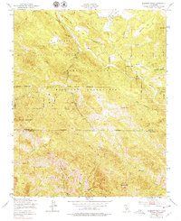
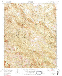
1949 Map of Burnett Peak
USGS Topo · Published 1979About this map
The Santa Lucia Range dominates this landscape on the Central Coast, where the high ridges of Burnett Peak and Bald Mtn overlook a complex network of canyons and creek beds. This 1949 survey illustrates the sprawling reach of the Hunter Liggett Military Reservation, which occupies a significant portion of the central and northern terrain. The Nacimiento River carves a path through the northern section, passing by landmarks such as Italian Flat and The Palisades.
Find a feature on this map
29 named features on this map. Tap any name to fly to it.
Don’t see what you’re looking for? This feature index may not catch every label — zoom into the map to look around manually.
Map Details
Editions of this 1949 Burnett Peak Map
5 editions found
Other maps of this area

1919 · Bryson
USGS Topo · 1:62,500

1919 · Piedras Blancas
USGS Topo · 1:62,500

1919 · San Simeon
USGS Topo · 1:62,500

1921 · Cape San Martin
USGS Topo · 1:62,500

1927 · Piedras Blancas
USGS Topo · 1:62,500

1937 · San Simeon
USGS Topo · 1:62,500

1941 · Cape San Martin
USGS Topo · 1:62,500

1941 · Bryson
USGS Topo · 1:62,500

1942 · Bryson
USGS Topo · 1:62,500

1942 · Cape San Martin
USGS Topo · 1:62,500