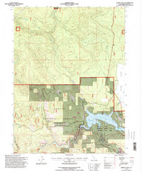
1995 Map of Burney Falls
USGS Topo · Published 1998About this map
Lake Britton serves as the central focal point of this 1990s revision, where the Pit River is managed by the Pit No 3 Dam. The landscape is a complex intersection of public lands and recreation, most notably the Mc Arthur Burney Falls Memorial State Park and the sprawling Shasta National Forest. Evidence of the area's earlier settlement and family history remains visible through features like the Pioneer Cem and Benton Cem, alongside former transportation nodes like the Cayton Siding and a Ferry crossing. The map traces the winding path of the Pacific Crest National Scenic Trail as it traverses the high ground near Bird Flat and Rock Creek. Small residential and service pockets such as Cayton, Delucci, and the Clark Creek Lodge highlight the localized human footprint within the timbered terrain.
Find a feature on this map
45 named features on this map. Tap any name to fly to it.
Don’t see what you’re looking for? This feature index may not catch every label — zoom into the map to look around manually.
Map Details
Editions of this 1995 Burney Falls Map
2 editions found
Other maps of this area

1886 · Lassen Peak
USGS Topo · 1:250,000

1886 · Modoc Lava Bed
USGS Topo · 1:250,000

1892 · Modoc Lava-Bed
USGS Topo · 1:250,000

1892 · Lassen Peak
USGS Topo · 1:250,000

1894 · Lassen Peak
USGS Topo · 1:250,000

1932 · Bartle
USGS Topo · 1:96,000

1935 · Burney
USGS Topo · 1:96,000

1939 · Burney
USGS Topo · 1:125,000

1939 · Bartle
USGS Topo · 1:125,000

1954 · Alturas
USGS Topo · 1:250,000