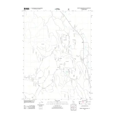
2012 Map of Burney Mountain East
USGS Topo · Published 2012About this map
Hat Creek serves as the primary corridor for settlement and recreation in this high-elevation landscape of eastern Shasta County. The terrain is defined by volcanic features and high-altitude water sources, where prominent landforms like Cinder Butte and Doyle Butte rise above the surrounding flats. Historical navigation and access are represented by a dense network of forest routes, including Forest Rte 34N19 and Forest Rte 34N22, which connect the various natural springs and peaks. The presence of Honn Campground and several water features such as Cornaz Lake, Pot Spring, and Burney Spring indicates the area's importance for local resource management and seasonal use. This 2012 survey illustrates the modern landscape of the Lassen National Forest region, preserving the names of remote peaks like Cornaz Peak and Red Rock Hill alongside the established community infrastructure at Hat Creek.
Find a feature on this map
72 named features on this map. Tap any name to fly to it.
Don’t see what you’re looking for? This feature index may not catch every label — zoom into the map to look around manually.
Map Details
Editions of this 2012 Burney Mountain East Map
This is the sole edition of this map. No revisions or reprints were ever made.
Other maps of this area

1886 · Lassen Peak
USGS Topo · 1:250,000

1892 · Lassen Peak
USGS Topo · 1:250,000

1894 · Lassen Peak
USGS Topo · 1:250,000

1935 · Burney
USGS Topo · 1:96,000

1939 · Burney
USGS Topo · 1:125,000

1939 · Halls Flat
USGS Topo · 1:125,000

1955 · Westwood
USGS Topo · 1:250,000

1956 · Manzanita Lake
USGS Topo · 1:62,500

1957 · Prospect Peak
USGS Topo · 1:62,500

1957 · Burney
USGS Topo · 1:62,500