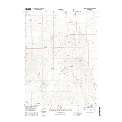
2015 Map of Burney Mountain East
USGS Topo · Published 2015About this map
Hat Creek Valley and the northern reaches of Lassen National Forest define this landscape dominated by volcanic topography and alpine hydrology. The map showcases a series of prominent peaks and volcanic features, from the elevation of Burney Mtn and Twin Buttes to the distinct cinder formations of Cinder Butte and Dudgen Butte. Water sources are vital markers in this terrain, with Hat Creek flowing northward, supported by upland sites like Cornaz Lake and Cornaz Spring. Local transit is represented by named routes including Lava Flat Lane and Doty Road, while the surrounding Eiler Gulch illustrates the complex drainage patterns of the Shasta County highlands. This survey provides an exact look at the intersection of protected forest lands and high-country landmarks.
Find a feature on this map
37 named features on this map. Tap any name to fly to it.
Don’t see what you’re looking for? This feature index may not catch every label — zoom into the map to look around manually.
Map Details
Editions of this 2015 Burney Mountain East Map
This is the sole edition of this map. No revisions or reprints were ever made.
Other maps of this area

1886 · Lassen Peak
USGS Topo · 1:250,000

1892 · Lassen Peak
USGS Topo · 1:250,000

1894 · Lassen Peak
USGS Topo · 1:250,000

1935 · Burney
USGS Topo · 1:96,000

1939 · Burney
USGS Topo · 1:125,000

1939 · Halls Flat
USGS Topo · 1:125,000

1955 · Westwood
USGS Topo · 1:250,000

1956 · Manzanita Lake
USGS Topo · 1:62,500

1957 · Prospect Peak
USGS Topo · 1:62,500

1957 · Burney
USGS Topo · 1:62,500