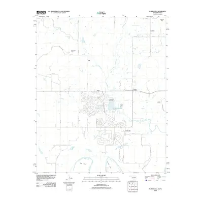
2010 Map of Burneyville
USGS Topo · Published 2010About this map
Burneyville and the southern reaches of Love County sit at the edge of the Red River in this 2010 survey. The landscape is defined by the winding course of the river, which creates deep loops at Tyas Bend and Warrens Bend along the state border. Inland, the geography is shaped by the Walnut Bayou and several tributaries like Simon Creek and Bone Creek, flowing through a region where small communities like Pike, Turner, and Dunbar are linked by a network of rural roads.
Find a feature on this map
47 named features on this map. Tap any name to fly to it.
Don’t see what you’re looking for? This feature index may not catch every label — zoom into the map to look around manually.
Map Details
Editions of this 2010 Burneyville Map
This is the sole edition of this map. No revisions or reprints were ever made.
Other maps of this area

1901 · Ardmore
USGS Topo · 1:125,000

1902 · Gainesville
USGS Topo · 1:125,000

1918 · Ardmore
USGS Topo · 1:125,000

1943 · Gainesville
USGS Topo · 1:125,000

1954 · Sherman
USGS Topo · 1:250,000

1957 · Ardmore
USGS Topo · 1:250,000

1958 · Sherman
USGS Topo · 1:250,000

1963 · Ardmore
USGS Topo · 1:250,000

1964 · Overbrook
USGS Topo · 1:24,000
1968 · Thackerville
USGS Topo · 1:24,000